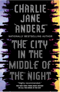
I’ve read a bunch of Charlie Jane Anders’ short fiction and never understood why it was so popular. I figured reading something long form would help clarify this situation and it did, but not in the way I wanted. Here’s my problem with the writing of hers I’ve read so far: there are few interiors. She very rarely tells you how a character feels, in a lived-in way. There’s a scene where Sophie, one of the heroines, collapses from emotion, and it’s described in a weirdly clinical manner, all physical movement and acknowledgment of facts, but without any visceral reaction. It’s the reading equivalent of watching a puppet show instead of human or even animated actors: there are broad strokes meant to simulate feeling but everything feels dead behind the eyes. I don’t know if this is a deliberate choice not to describe how people feel via interior voice — there are definitely bullshit writing advice websites out there promoting dispassionate storytelling with the claim that it somehow makes people feel character emotions more vividly — but it serves to make me feel at a complete arm’s length from anything going on in the narrative.
 As to the narrative, woof. Okay, so there are some really great concepts here. A Mothership filled with humans fleeing a dying Earth landed on a tidally locked planet they called January. They built a series of cities in the twilight, temperate zone but as generations pass, the cities close off from one another and begin to decay, as entropy wins against adaptability. In Xiosphant, the biggest(?) city of a million people or so, citizens are ruled by a way of life called Circadianism, which strictly allocates when people are allowed to work, sleep or otherwise exist. Our first viewpoint character Sophie escaped the constraining expectations of her middle-class Xiosphanti lifestyle by winning a scholarship to the Gymnasium, an elite school for the best and brightest. She falls madly in love with her roommate Bianca, who is beautiful and rebellious in the way only privileged people can afford to be. When she takes the fall for a crime Bianca committed, Sophie is exiled to the night side, but is saved via an unexpected encounter with a member of the other sentient species on the planet, a species humanity refuses to see as anything but animals.
Our other viewpoint character is Mouth, the only survivor of a nomadic people who now works with a group of adventurers who are part courier but mostly smuggler. Her fighting skills are unparalleled, and when she hears that a copy of the last remaining book of her people is tucked away in the Xiosphant palace, she falls in with a group of student rebels planning to besiege it. One of these rebels is Bianca, who was radicalized by Sophie’s arrest and exile, and is now determined to liberate her fellow citizens from their dystopian government. Of course, little goes to plan, and Mouth, Bianca and Sophie eventually find themselves agents of planetary change.
There’s so much potential here but so little makes sense. The systems of Xiosphant sound interesting until you take into account how the place is geographically impossible given the distances Sophie allegedly covers on foot, even before her last return to the city. Argelo hangs together better as an anarchic city ruled by nine different gang families, until you ask how Sophie and Bianca manage to pay for their party hearty lifestyles before Dash takes an interest in Bianca. As with the lack of interior emotion, there are weird gaps in the logic of things that shouldn’t even be a concern. Like, I understand why the Gelet thought Sophie would make a terrific ambassador because they obviously don’t know enough about humans to know what a terrible idea that is — that makes sense. But just everyday questions of space and time and, again, human emotion are ignored in such a way as to make the mistakes feel glaringly obvious.
Possibly the worst of these is in Sophie’s obsession with Bianca. At 93% of the book, Mouth describes Sophie as an idiot, and it seems that the line was thrown in as an afterthought, Ms Anders acknowledging to the reader that yes, our heroine is hard to root for but hey, she realizes it too! To which: so maybe stop making her be an idiot?! Our knowing that you know she sucks doesn’t make her suck any less! But okay, fiction lives for people doing incredibly stupid things for love, even when the object of affection also objectively sucks.
What’s less forgivable is the way Ms Anders treats Mouth. Mouth is blamed for the failure of the Xiosphanti student rebels when it was likely Bianca’s fault they were discovered at all. Yes, she encouraged Bianca’s revolutionary interests but so did everyone else involved in their little plot, and instead of anyone acknowledging that they were as much to blame as she was, she’s cast as the villain for some bizarre reason.
I was also deeply uneasy with the way Mouth’s relationship to her dead peoples was treated. Sure, they turned out to be a cult but the ease with which the proudly Jewish Alyssa dismissed Mouth’s desire to protect her heritage before finding any of that out felt really wrong to me. I absolutely agree that the idea of heritage should be something that needs to be studied and considered critically, and that there are lots of things people shouldn’t throw away their lives over, but being the sole survivor of an extinct people seems like a perfectly good impetus for Mouth to want to recover anything that can teach her more about them. It was really bizarre to see Mouth vilified for any number of perfectly understandable motivations, considering that she was surrounded by people who sucked way harder.
Anyway, I’ve heard that All The Birds In The Sky is better so maaaaaybe I’ll give that a chance once I’ve dug myself out from under all the reading on my current slate, whenever that is.
 Drops are the name for the process that transports soldiers thousands of miles through space by busting them down to light and reconstituting them at the other end. It isn’t foolproof — people do wind up with limbs improperly reattached or in the middle of solid structures — but it’s fast and relatively cheap. Trouble is, Dietz doesn’t seem to move just through space but also through time, and what she sees isn’t pretty. Is she going mad or is she part of a Light Brigade that could very well save the world from itself?


